
I travelled to Patagonia at the end of January, 2006, on a two week tour led by GAP Adventures. This page has photos from the trip. I have also written some notes about my trip to Patagonia. [Updated 28 Feb, 2006]
Our trip started in Buenos Aires, but I have no photos from there at present. Don't get me wrong, it's a nice city, but it's not Patagonia.
|
|
|
|
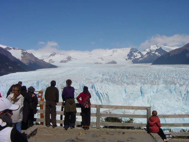
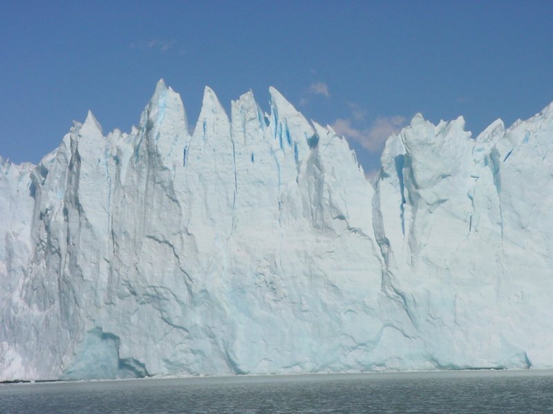
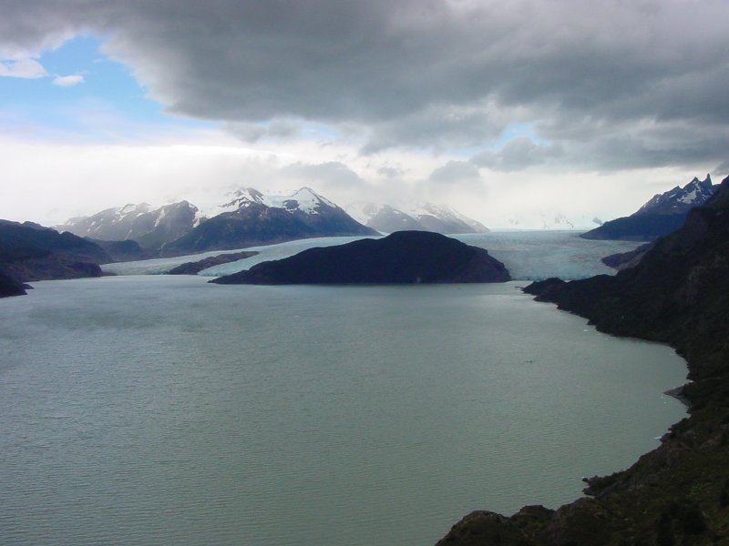
Looking at the glacier it's impossible to get a sense for its true size, because there is nothing to compare it to. The visible ice wall rises 60 meters (the height of a 25 story building), and there is twice as much ice below the lake surface. You really can't tell how big it is unless you see someone walking across it, then you understand that the tiny dot is a person.
When the ice falls, you hear a sharp crack, a little bit like thunder. When people first come to the glacier, and they hear the sound, they quickly look around to see a piece of ice falling, but they never see any that way. By the time the sound reaches you, the ice has hit the water. This is either because the sound itself is only made in reaction to the ice breaking free, or, more likely I think, because the glacier is really much further away than you think, and just as thunder follows lightning, the sound takes a second or two to reach you.
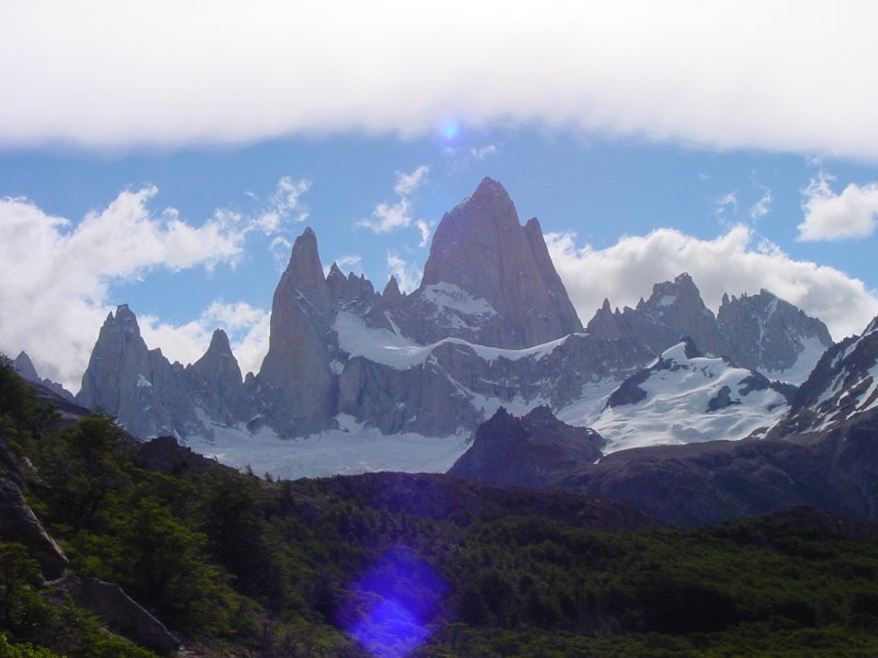
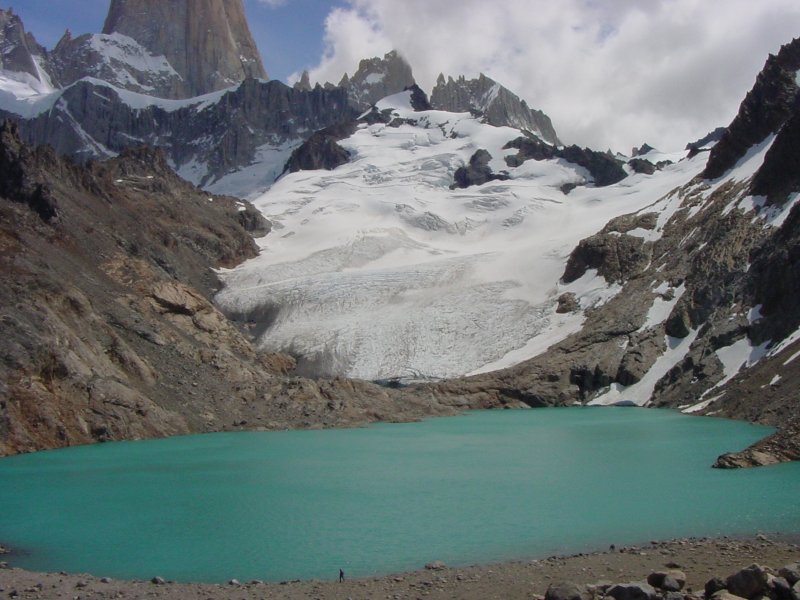
From El Calafate we rode a bus to the north, around Lago Argentina and Lago Viedma to the town of El Chalten, which is the home base for all those who want to climb or just hike amidst the peaks of the park.
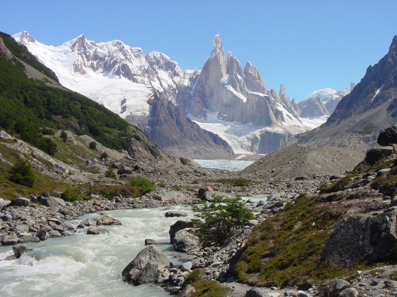
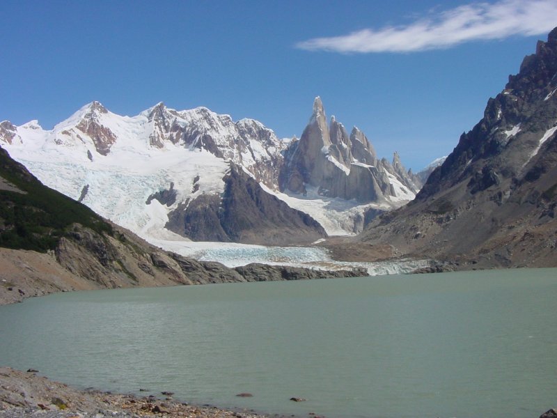
These mountains are formed by fingers of granite which rose up into softer sedimentary rock some 16 million years ago. The surrounding rock eroded, leaving only the granite peaks. We had two long dayhikes in the park, one to Laguna de Los Tres, at the foot of Fitz Roy, and one to Laguna Torre, at the base of Cerro Torre.
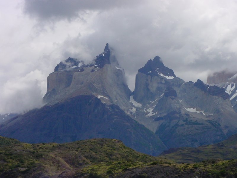
Our next stop was the Parque Nacional Torres (Towers) del Paine, in Chile. The geology of the park is similar to that of Los Glaciares in Argentina - granite intrusions into sedimentary rock. Approaching the park from the south, one sees first the Cuerno (horns) del Paine. Here, the very top of the mountain is a dark metamorphic rock (Cretaceous) that was baked by the heat of the granite to a greater hardness. The Cuernos are often mistakenly labelled as the Torres del Paine, even on some travel web sites that should know better.
We had three long hikes in this park. The first hike (16 kilometers) took us up to a view of Grey Glacier. Like the Moreno, this comes down from the Campo Hielo del Sur. The second day's hike (24 kilometers) led to the Italian camp, then up the French Valley. The third day we hiked up to the Chilean Camp, then up to the Torres themselves, which are not visible from outside.
 Cuernos del Paine. |
 Grey Glacier, with southern ice field in the distance. |
|||||||
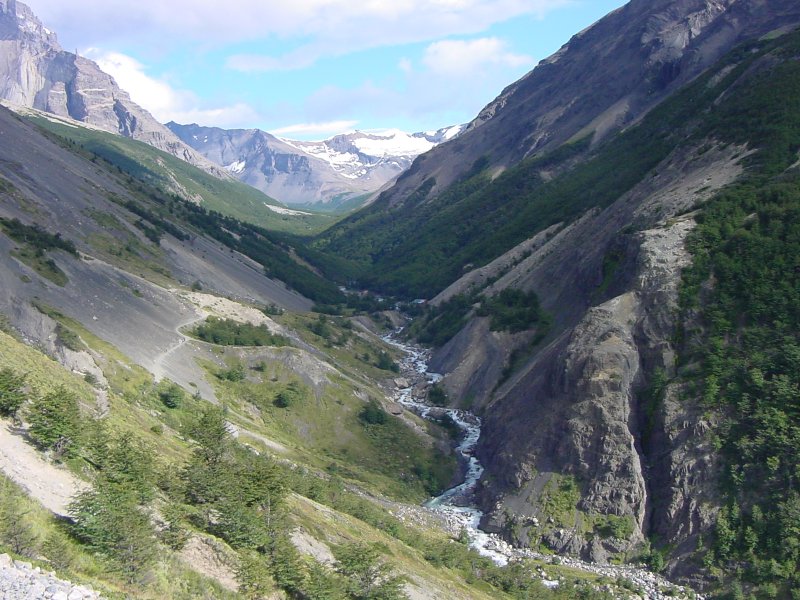
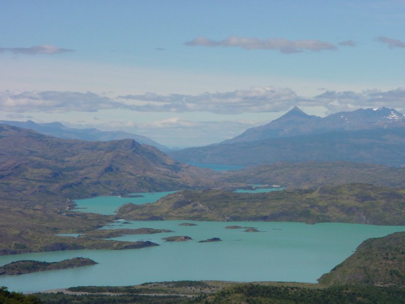 The view back to the south from the French Valley trail. Lago Nordenskjöld is the nearer, Lago Pehoe behind. Lago del Toro in the distance. |
 A small glacier, descending the west wall of the French Valley. |
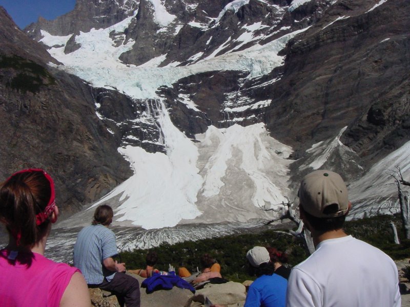 Same glacier, closer. We saw many avalanches there. |
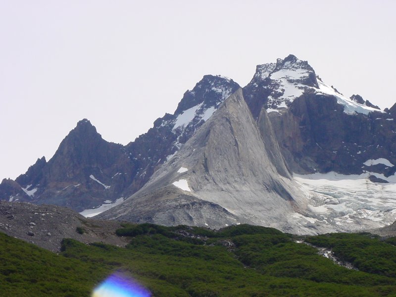 The Shark Fin, near the head of the French Valley |
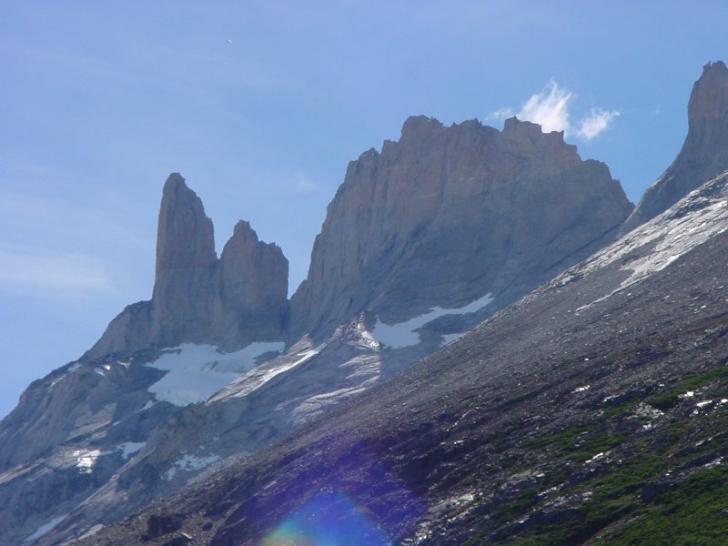 The spade, same general area. Note that the granite is two different colours, on a horizontal line running roughly halfway up the peaks. (It's more obvious in person.) |
||||
 The trail up the valley to the Torres del Paine |
|
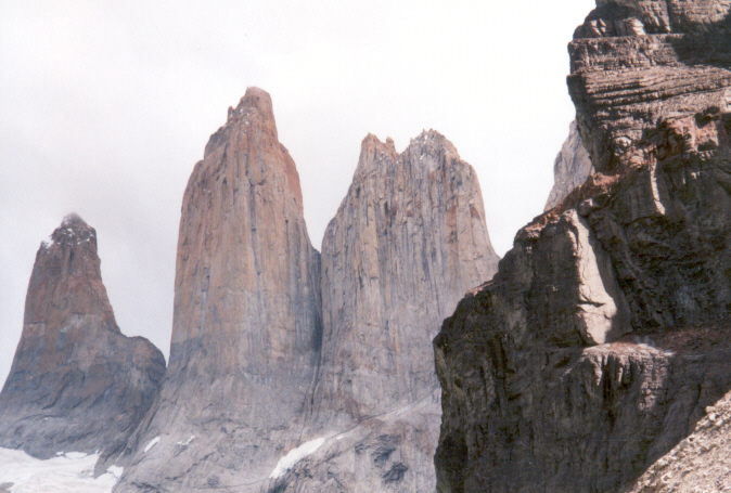 Torres del Paine. Note the change in colour in the granite about a third of the way up from the base. Photo by Hongchen Qiu |
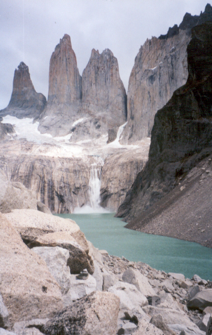 Torres, the lake, and an avalanche. That white patch that you might think is a waterfall is really a huge mass of ice and snow breaking off the glacier and tumbling into the lake. Note the huge splash below. This picture also gives you a sense of the morraine - a very large pile of broken rock torn from the Torres. Photo by Hongchen Qiu |
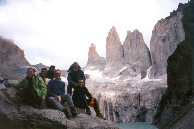
Our group, on the morraine in front of the Torres. Left to right: Miriam, Cory, Ro (our local guide), me, Chrisian, Evan. Note that the avalanche has ended. Photo by Hongchen Qiu |
||||
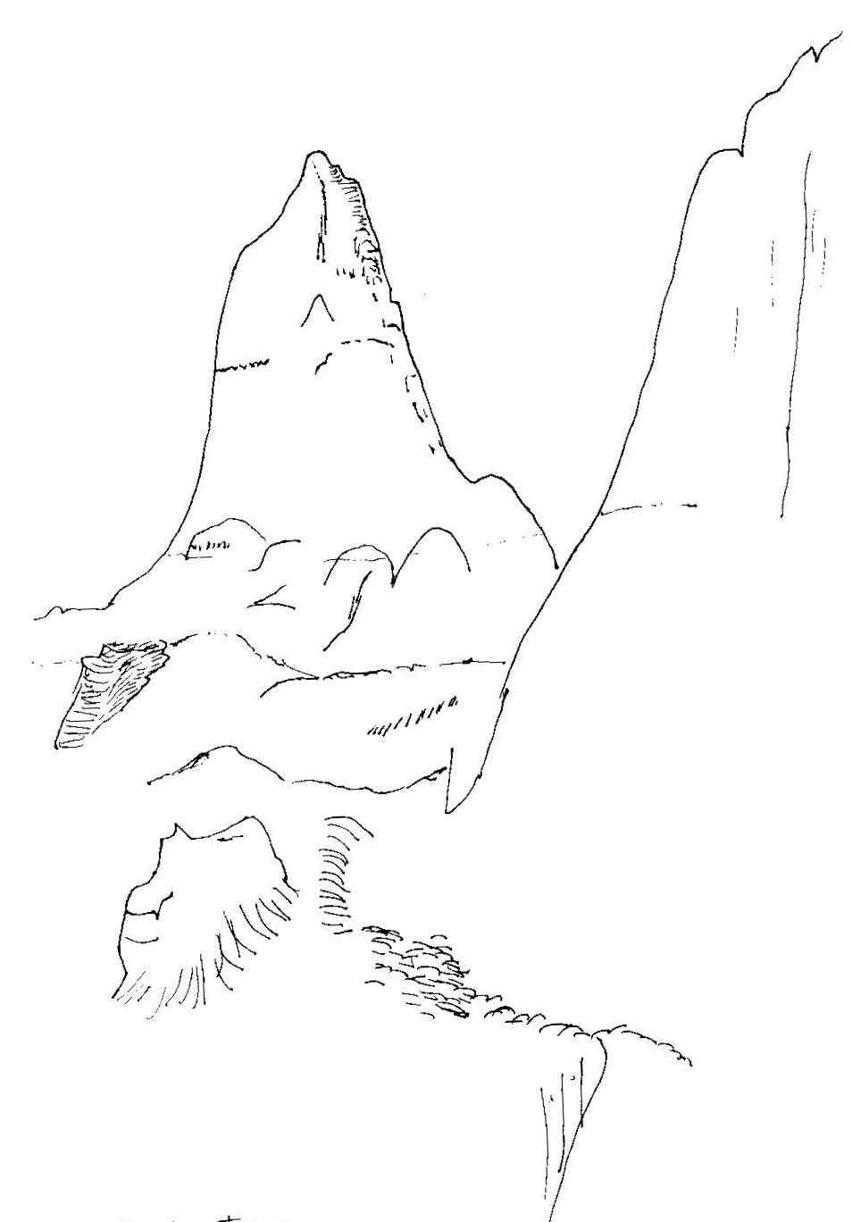
Unfortunately I don't have any photos of the three Torres del Paine. I hope to get some from the people on my trip. Perhaps these sketches will do for now.
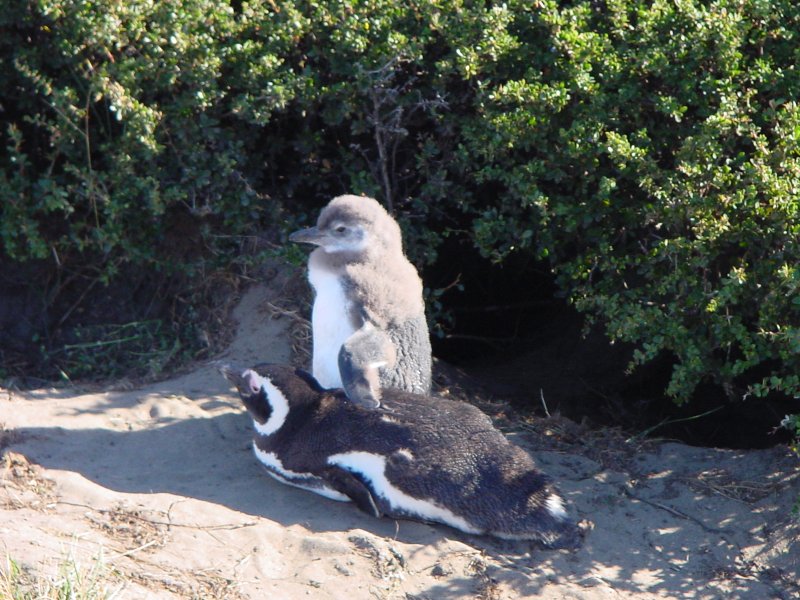 Penguin chick with parent. |
 |
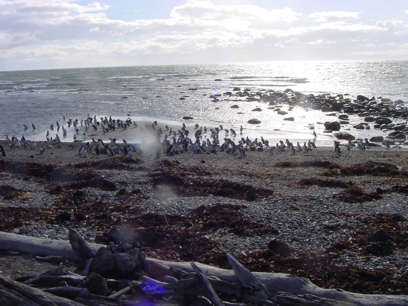 Penguins coming ashore. |